


les angles

lablaquiere
User
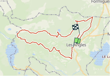

Length
23 km

Max alt
2368 m

Uphill gradient
907 m
Km-Effort
35 km

Min alt
1656 m

Downhill gradient
831 m
Boucle
No
Creation date :
2021-07-16 07:54:11.884
Updated on :
2021-07-16 13:09:40.212
4h01
Difficulty : Difficult

FREE GPS app for hiking
 SityTrail
IGN / Geographical institutes
SityTrail Plus
The world is yours!
About
Trail Mountain bike of 23 km to be discovered at Occitania, Pyrénées-Orientales, Les Angles. This trail is proposed by lablaquiere.
Positioning
Country:
France
Region :
Occitania
Department/Province :
Pyrénées-Orientales
Municipality :
Les Angles
Location:
Unknown
Start:(Dec)
Start:(UTM)
423599 ; 4714074 (31T) N.
Comments